
 The Charlotte region is now under a severe storm warning for most of Good Friday.
The National Weather Service has just issued the following alert;
“A band of heavy rain showers and embedded thunderstorms is expected to move across the foothills and Piedmont today. Isolated severe thunderstorms capable of producing locally damaging wind gusts and isolated brief tornadoes will be possible, especially across the Piedmont, and especially in the late morning and afternoon. In addition, localized excessive rainfall may cause flash flooding of small streams and urban areas.”
Here’s a rough timeline of what to expect as far as severe storms today. We’re most concerned about the threat for damaging wind across the whole area, with the greatest risk of tornadoes east of I-77. Any tornadoes that form could spin up FAST, so heed all warnings right away! pic.twitter.com/mGNoWjkMar
— NWS GSP (@NWSGSP) April 19, 2019
According to WeatherUnderground.com, the Charlotte area could see up to 2 inches of rain today, and we’ll be seeing the worst of the storm between 2pm and 6pm this afternoon;
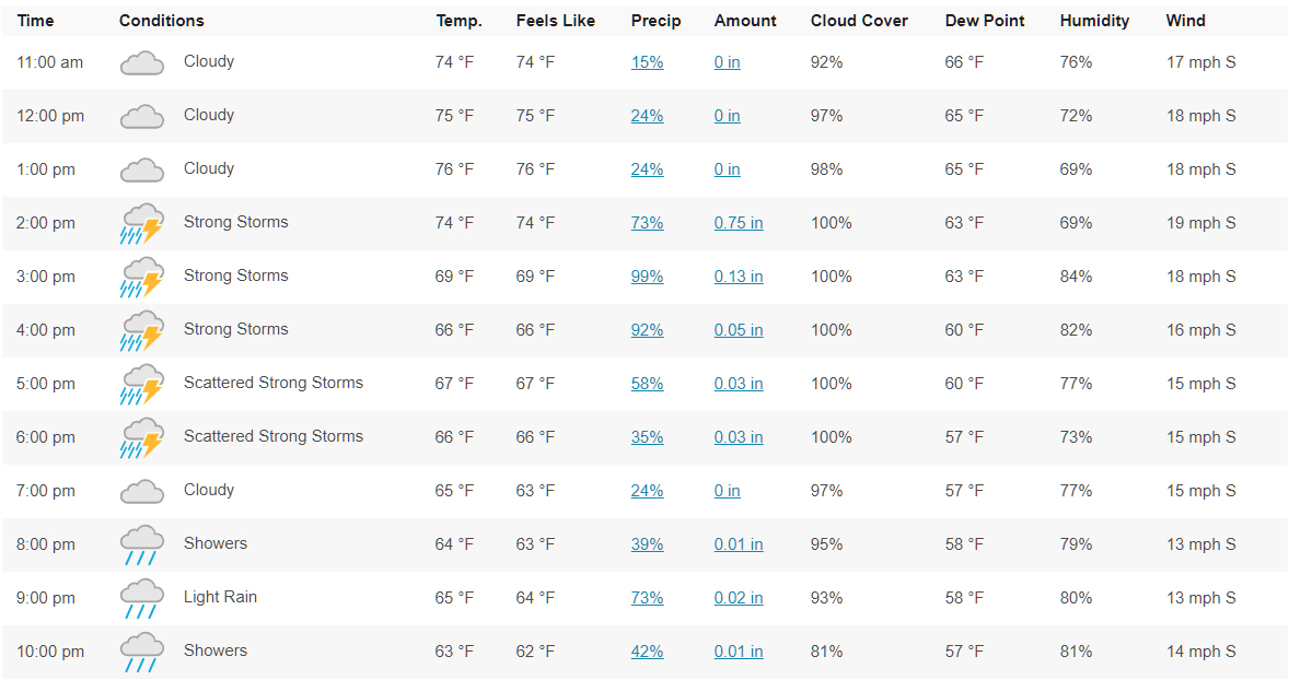
The rest of this Easter weekend should be beautiful, with sunny skies and upper-60s on Saturday and sunny skies and mid-70s on Easter Sunday.
