
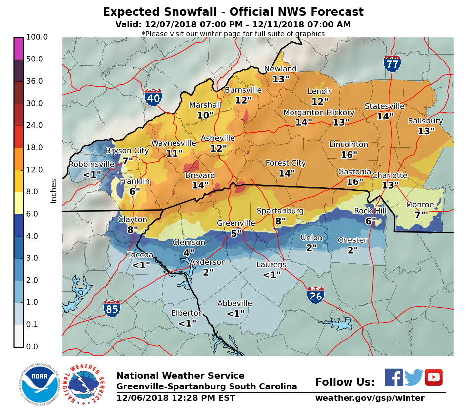
UPDATE 12/6/2018 12:30pm:
The National Weather Service has just increased their snowfall predictions for our region. They are now predicting 13″ of snowfall for Charlotte and 16″ of snow for Gastonia between Friday (12/07) and Tuesday (12/11);
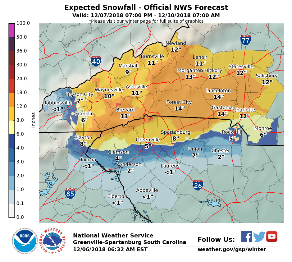
Original Article 12/6/2018 6:00am:
According to a new alert sent out this morning by the National Weather Service, Charlotte could see over 12 inches of snow this weekend during what they term a “once-in-a-generation event”.
This morning they released their updated snowfall prediction map;
They also predict up to .16 inches of solid ice accumulation, with even more expected for Monroe and Rock Hill;
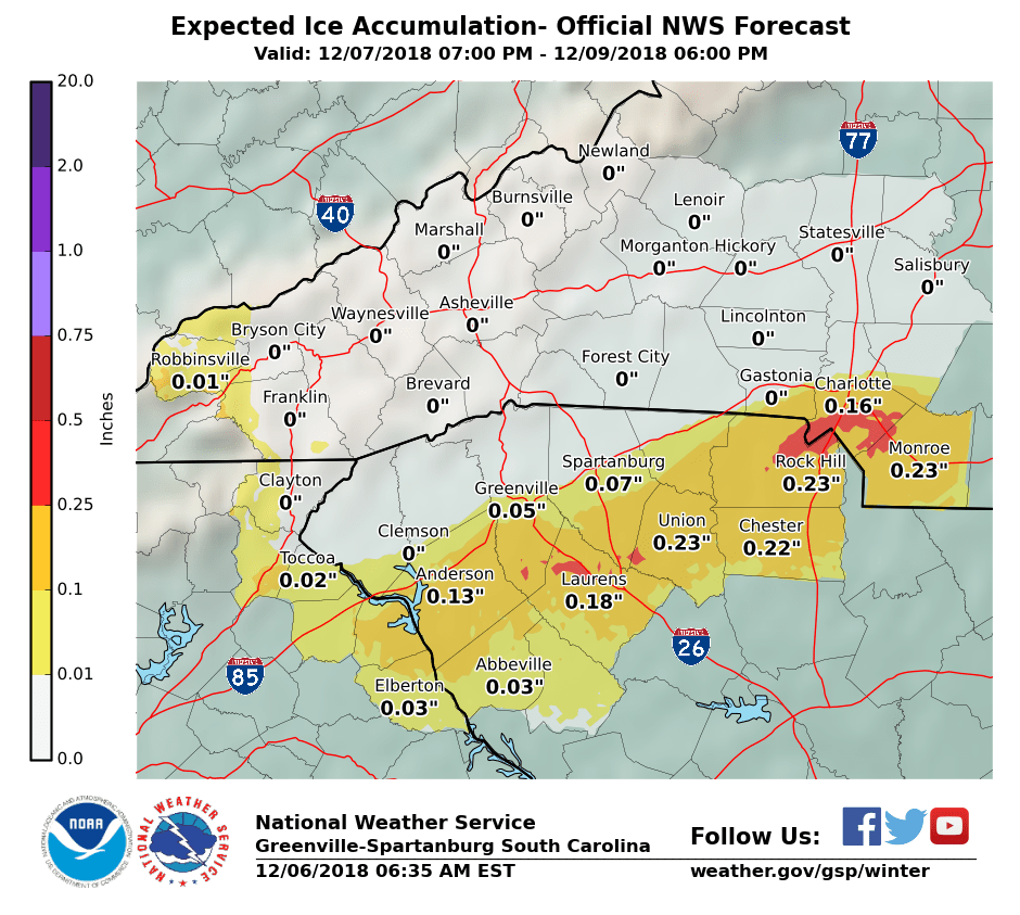
According to the recent alert by the National Weather Service;
“Early estimates continue to place snow amounts between 10 and 20 inches across the mountains, foothills Piedmont northwest of I-85. Local 20+ amounts are possible across higher east facing mountain and foothill locations. Dangerous freezing rain and sleet accumulations in excess of one half an inch continue to be possible with the high totals and therefore impacts between I-85 and I-40 outside of the mountains. Although latest model trends suggest areas closer to I-85 might have the most cause for concern.
The bottom line is that a potentially very dangerous winter storm looms for much of the forecast area this weekend. And as the day shift yesterday put it, this could be a once-in-a-generation event for areas that experience mostly snow and ice. Now is the time to prepare. Finish preparations by Friday as if this storm speeds up Saturday may be too late, especially for the Upstate of SC into northeast GA.”
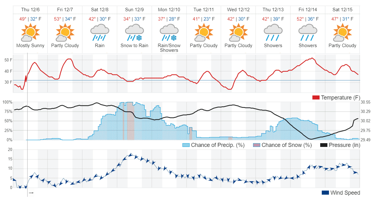
According to Weather Underground, we’ll likely see the first snowflakes fall Saturday morning between 8am-11am, with the majority of snow falling Saturday night and Sunday night;
It’s now being recommended that Charlotte residents lay down de-icing salt on sidewalks and driveways and prepare for possible power outages and impassable roads before the storm hits.
Follow NC Emergency Management and NCDOT on Facebook and Twitter for the latest storm updates. Real-time weather and road conditions, as well as winter safety tips, can be found on the free ReadyNC mobile app or online at readync.org.
Travelers are urged to go to drivenc.gov for up-to-date roadway conditions. Motorists are reminded NOT to call 911 or the State Highway Patrol Communication Centers for roadway conditions.
