
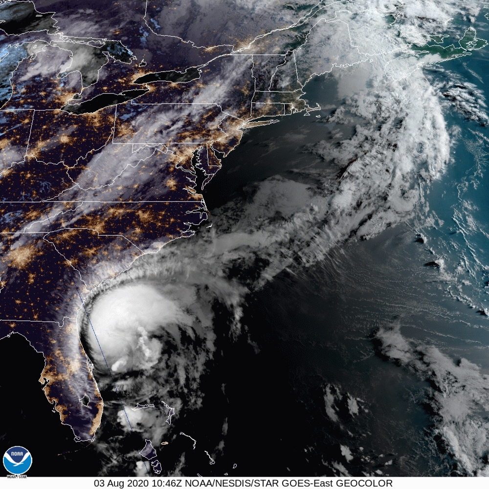
Tropical Storm Isaias is now expected to become Hurricane Isaias before making landfall in the Carolinas.
The National Hurricane Center just released the following update on the storm:
Data from the reconnaissance aircraft and NOAA Doppler weather
radars indicate that maximum sustained winds remain near 70 mph
(110 km/h) with higher gusts.  Some strengthening is forecast this
afternoon, and Isaias is expected to regain hurricane strength just
before it reaches the coast of northeastern South Carolina or
southern North Carolina tonight. Only slow weakening is anticipated
after Isaias makes landfall in the Carolinas and moves across the
U.S. mid-Atlantic region tonight and Tuesday.
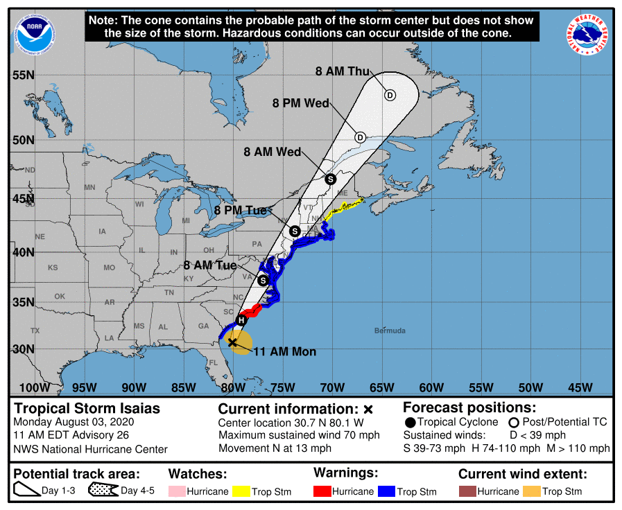
Governor Roy Cooper has declared a state of emergency for North Carolina ahead of Hurricane Isaias’ expected landfall, saying that our state is already seeing extremely high risk of deadly rip currents all along the coast.
“A hurricane during a pandemic is double trouble, but the state has been carefully preparing for this scenario so we can do our best to keep people safe from the weather, as well as the virus,” the governer said in the briefing.
You can watch the entire media briefing here:
“Although the track and arrival of the hurricane could still change, now is the time for North Carolinians to prepare,” said Governor Cooper. “Hurricane preparations will be different given the COVID-19 pandemic, and families need to keep that in mind as they get ready.”
Officials are reminding all residents in Atlantic Coast states to prepare.
In case of a power outage, make sure to have the following emergency items stocked in your home;
- Car charger for cell phones and other devices
- Clean drinking water (recommended 1 gallon per person per day, minimum three days)
- Flashlights
- Batteries: Extra batteries for all of your devices
- Weather radio/clock
- Non-perishable food
- First aid kit
We will continue to update this article as this storm develops.

