
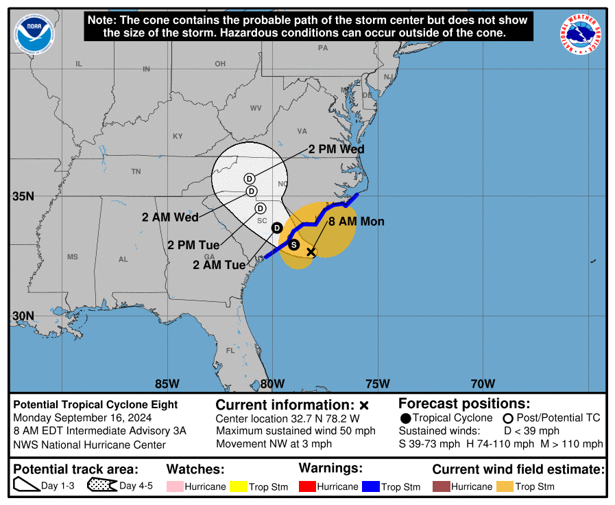
Potential Tropical Cyclone Eight is on track to strengthen into Tropical Storm Helene, with landfall expected near Charleston.
The system, currently 100 miles east of Charleston and 85 miles south of Cape Fear, is already bringing strong winds and heavy rain to southeastern North Carolina. The National Hurricane Center has issued a Tropical Storm Warning for coastal areas from Edisto Beach, to Ocracoke Inlet.
As the storm moves inland, it will closely follow the path from Charleston to Charlotte, up I-26 and I-77. A Flood Watch is in effect for much of eastern North Carolina and northeastern South Carolina. Heavy rainfall and localized flooding are expected, as the storm progresses inland after potential landfall.
Potential Tropical Cyclone 8 is expected to make landfall along the SC coast this afternoon/evening, then move inland across the Carolinas tonight through Tuesday. Heavy rainfall and gusty winds are expected starting this afternoon through Tuesday morning. #scwx #ncwx #gawx pic.twitter.com/feBqPGUqtN
— NWS GSP (@NWSGSP) September 16, 2024
The NHC has classified the system as a potential tropical cyclone to enable early alerts, preparing residents along the Southeast coast. If the storm strengthens as predicted, it would become the eighth named storm of the season, taking the name Helene.
Communities along the coast are being urged to prepare for possible flooding and damaging winds. Coastal and inland residents should monitor weather updates closely as the storm develops over the next 24 to 48 hours.
NHS officials are reminding all residents in Atlantic Coast and Gulf states to be prepared for potential future storms.
In case of a power outage, make sure to have the following emergency items stocked in your home;
- Car charger for cell phones and other devices
- Clean drinking water (recommended 1 gallon per person per day, minimum three days)
- Flashlights
- Batteries: Extra batteries for all of your devices
- Weather radio/clock
- Non-perishable food
- First aid kit

