
A growing disturbance in the Atlantic is now predicted to become the 12th named storm of 2020 later today.
This morning, the National Hurricane Center sent out the following alert:
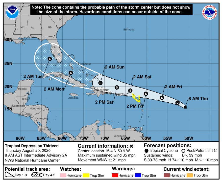
At 800 AM AST (1200 UTC), the center of Tropical Depression Thirteen
was located near latitude 15.4 North, longitude 50.9 West. The
depression is moving toward the west-northwest near 21 mph (33 km/h)
and this motion is expected to continue for the next few days.  On
the forecast track, the depression is expected to move near or north
of the northern Leeward Islands by late Friday and near or north of
the Virgin Islands and Puerto Rico on Saturday.

Maximum sustained winds are near 35 mph (55 km/h) with higher gusts.
Gradual strengthening is forecast, and the depression is expected to
become a tropical storm later today.
By the end of today, ‘Tropical Depression Thirteen’ will likely become ‘Tropical Storm Laura’ on a direct path toward the east coast of the US.
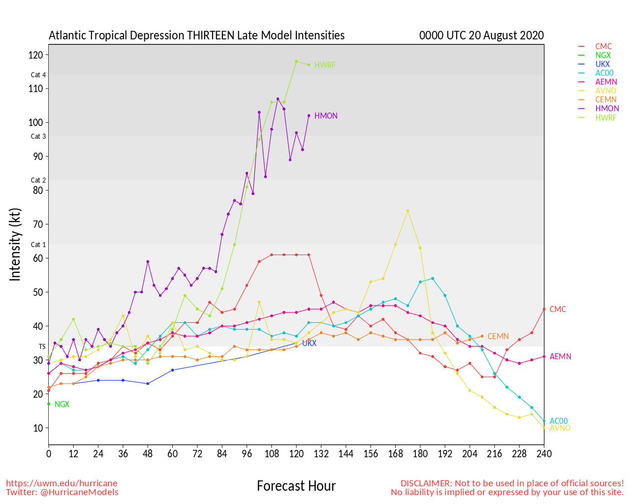
Late model intensities show the storm could increase in strength to a hurricane, possibly even a category 4 hurricane before it makes landfall in the states.
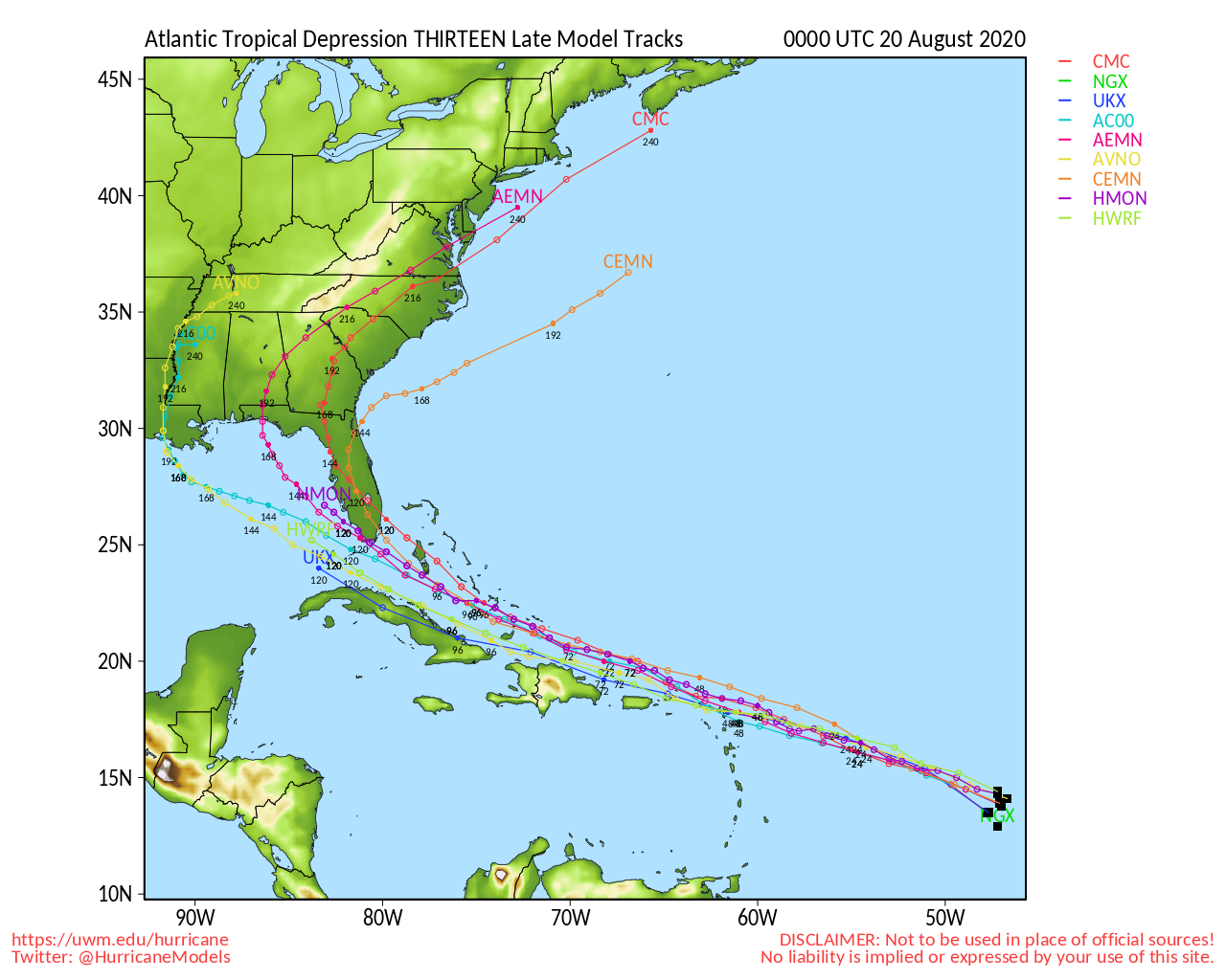
Several model paths of the storm have it sweeping through both North and South Carolina before it heads back out to sea.
The Atlantic Coast hurricane season for 2020 runs from June 1st through November 30th.
NWS officials are reminding all residents in Atlantic Coast states to be prepared for this hurricane season.
In case of a power outage, make sure to have the following emergency items stocked in your home;
- Car charger for cell phones and other devices
- Clean drinking water (recommended 1 gallon per person per day, minimum three days)
- Flashlights
- Batteries: Extra batteries for all of your devices
- Weather radio/clock
- Non-perishable food
- First aid kit
We will continue to update this article as this storm develops.

