
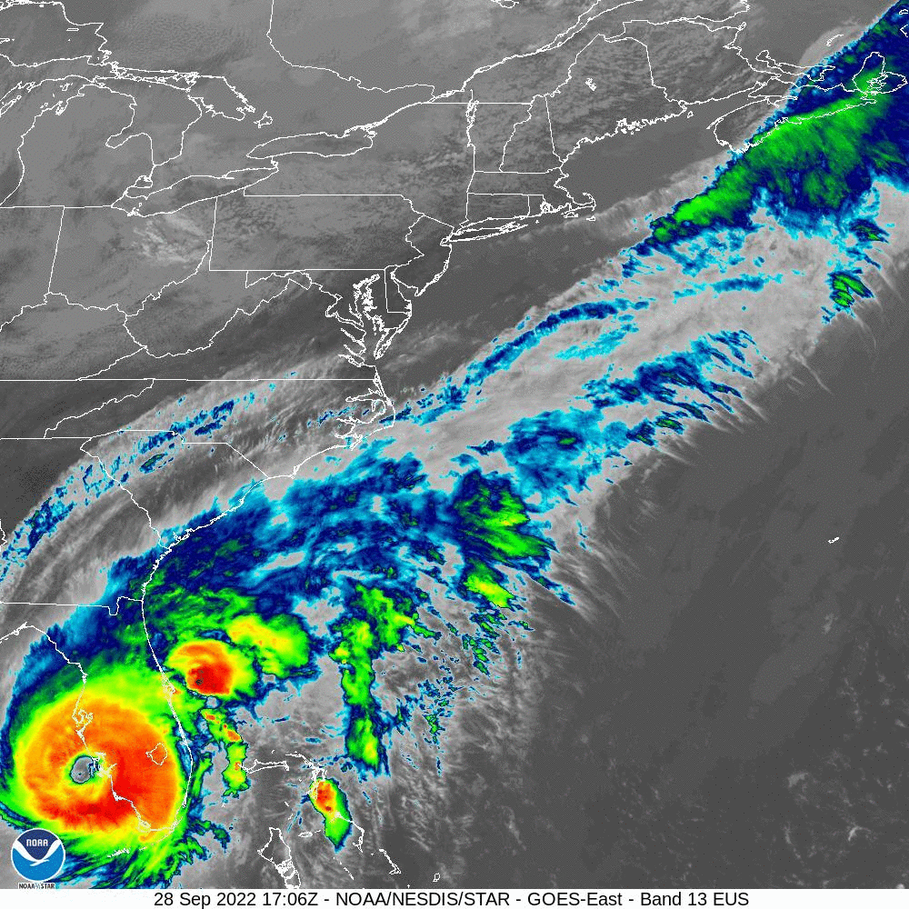
Category 4 Hurricane Ian just made landfall on the western coast of Florida as one of the largest storms to ever hit the state.
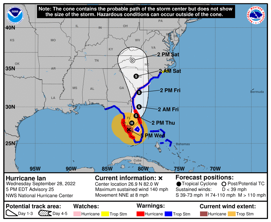
The National Hurricane Center is now predicting the storm to decrease in strength as it moves across Florida, then increase in strength over the Atlantic before swinging back into South Carolina on it’s way toward Charlotte as a Tropical Storm.
NOAA’s Storm Prediction Center just sent out the following alert for Saturday:
 On D4/Saturday, Ian is forecast to weaken into a post-tropical low
   as it moves into the southern Appalachian region (see NHC advisories
   and forecasts for more information regarding Ian). Low/midlevel flow
   to the east of Ian's decaying circulation may remain sufficiently
   strong to support isolated damaging wind gusts and/or a brief
   tornado from eastern NC into the Tidewater region.
In response to the forecasts and Ian’s historic size, Governor Cooper has just issued an official State of Emergency for North Carolina.
Today, Gov. Cooper declared a State of Emergency in advance of Hurricane Ian’s remnants moving through the state. A State of Emergency is needed so farmers and those preparing for the storm can quickly get ready for the heavy rain that is likely to fall.https://t.co/0CjnwFxPCQ pic.twitter.com/NfPiWYjjDO
— Governor Roy Cooper (@NC_Governor) September 28, 2022
NWS officials are reminding all residents in Atlantic Coast states to be prepared.
In case of a power outage, make sure to have the following emergency items stocked in your home;
- Car charger for cell phones and other devices
- Clean drinking water (recommended 1 gallon per person per day, minimum three days)
- Flashlights
- Batteries: Extra batteries for all of your devices
- Weather radio/clock
- Non-perishable food
- First aid kit
We will continue to update this article as this storm develops.
