
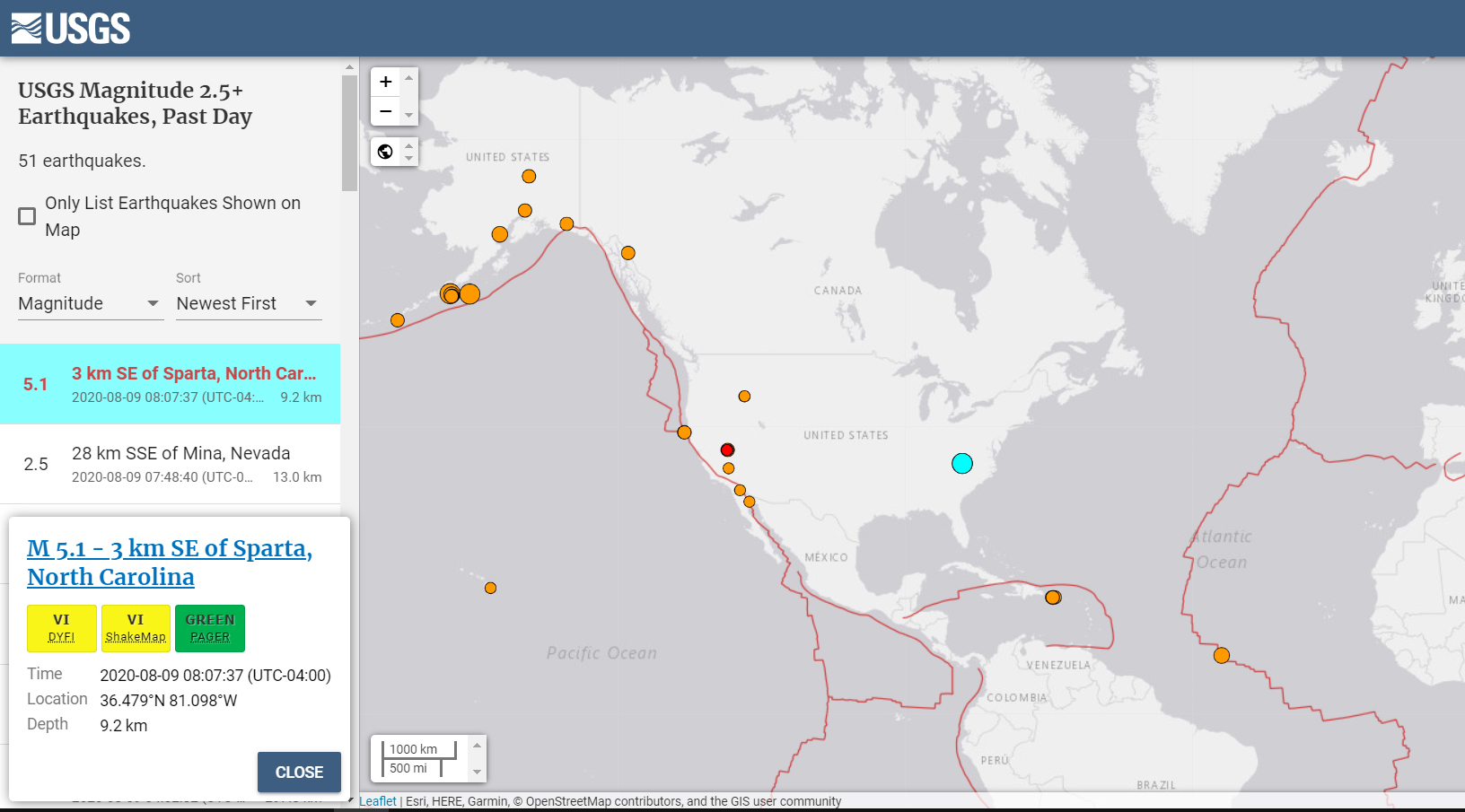
The Charlotte region was just rocked in what is now being confirmed as the largest earthquake in over 100 years.
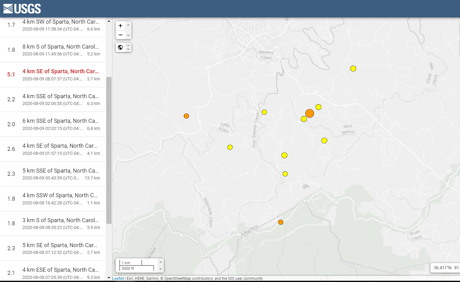
According to the USGS, a magnitude 5.1 earthquake just struck at 8:07 AM, located 3 KM southeast of Sparta, NC, and about 80 miles north of Charlotte. The Quake had a depth of 9.2 KM and an epicenter of 36.479°N 81.098°W.
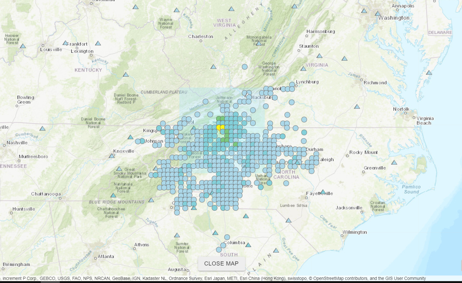
The USGS’s ‘Shake Map’, which pulls data from hundreds of seismographs throughout our region, shows that the earthquake was detected far away as Washington, DC. The quake rippled North Carolina’s fault line so hard, the Charlotte region experienced what felt like a direct magnitude 4 quake.
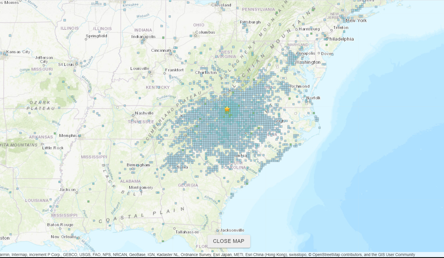
The USGS’s ‘Did You Feel It’ map shows that people have now reported feeling the quake as far away as Alabama and Pennsylvania:
Here is the mechanism for the magnitude 5.1 #earthquake that just occurred near Sparta, N.C.. It was also felt in CLT, ATL, and even parts of TN/Ohio.
This looks like an “oblique reverse” slip.
One block slipped below the other, and a bit laterally past it. pic.twitter.com/yxMc5EMxAh
— Matthew Cappucci (@MatthewCappucci) August 9, 2020
According to the Ditrianum organization, there’s a possibility of an even larger quake today or tomorrow;
Some critical planetary geometry (PG) combined with a lunar peak (LG) today could trigger larger seismic activity well over 6 magnitude in the next two days. pic.twitter.com/RLSUxHjt2Z
— Ditrianum ⚡ (@ditrianum) August 9, 2020
Earthquakes have been increasing in frequency around the Charlotte region over the past few years. Last year, we saw a 4.4 magnitude quake hit Decatur, TN, and a couple months ago, a 2.6 magnitude quake rocked a small town just north of Charlotte.
According to USGS.gov, “The largest earthquake in the area (magnitude 5.1) occurred in 1916. Moderately damaging earthquakes strike the inland Carolinas every few decades, and smaller earthquakes are felt about once each year or two.”
UPDATE 8/9/2020 8:15pm:
There have now been a total of 11 earthquakes that have rocked the Sparta, NC area over the past 48 hours, ranging in magnitude from 1.7 to 5.1.
Here is some of the damage caused by this morning’s historic quake:
Did you feel this morning’s quake?
