
 2018’s first named gulf coast storm is about to make landfall today, and many local residents are now bracing for the effects.
The eye of subtropical storm Alberto will be hitting Florida’s panhandle later today and traveling up the middle of the US, bringing flash flooding and powerful winds to the Carolinas.
According to the National Weather Service’s latest warning;
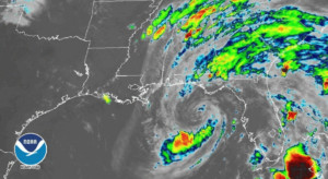 “Maximum sustained winds are near 65 mph (100 km/h) with higher gusts. Little change in strength is expected before Alberto reaches the northern Gulf Coast later today. Steady weakening is forecast after landfall, and Alberto will likely become a subtropical depression tonight or early Tuesday and degenerate into a remnant low by Tuesday afternoon.
Winds of 40 mph extend outward up to 105 miles (165 km) from the center. An elevated observing station located about 15 miles (25 km) south of Apalachicola, Florida, has recently reported sustained winds of 46 mph (74 km/h). A wind gust to 39 mph (63 km/h) was recently observed at Apalachicola, Florida.”
Nice image from #GOES16 of the sun setting over large subtropical storm #Alberto this evening. Alberto’s maximum sustained winds are now 65 mph as it moves northeastward towards the Gulf coast. Flooding rain remains the greatest concern for us over the next few days. pic.twitter.com/kxpimSJGxJ
— NWS GSP (@NWSGSP) May 28, 2018
The Carolinas will be hit especially hard by the storm, with the potential of up to 4″ of rain hitting our region within the next couple of days;
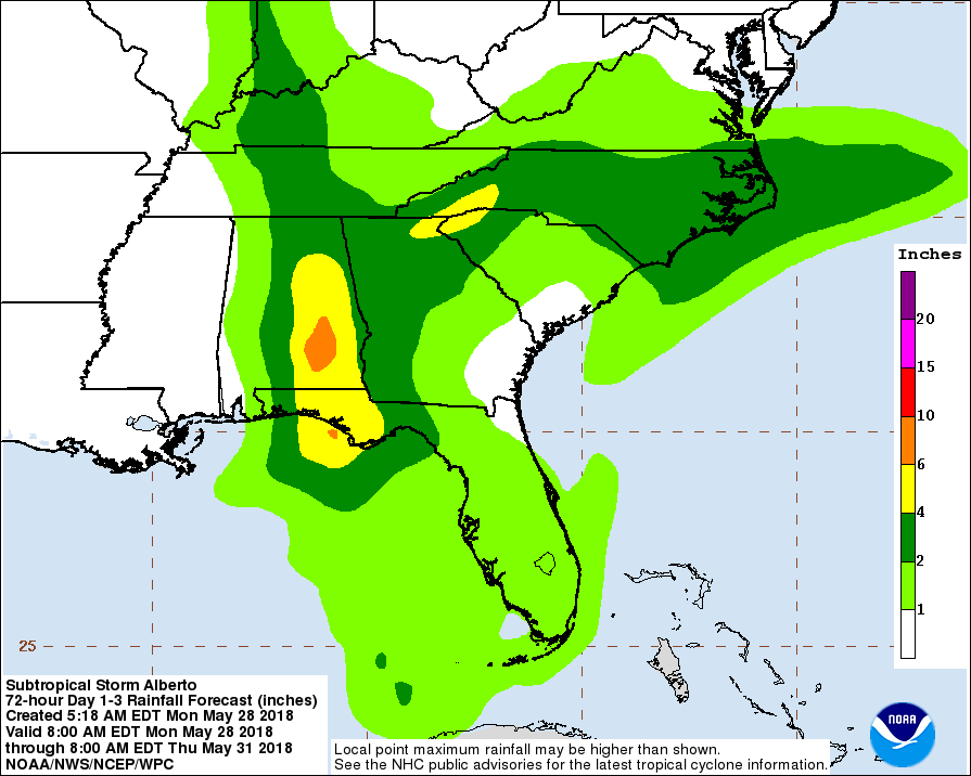
Flash flood watches have already been issued for most counties around the Charlotte region, including for Avery, Burke, Cabarrus, Caldwell, Catawba, Chester (SC), Chesterfield (SC), Cleveland, Gaston, Iredell, Lancaster, Lincoln, Mecklenburg, Rowan, Stanly, Union, and York (SC) counties through tomorrow morning.
Officials recommend anyone living in the above counties to prepare for possible power outages and flooded roads. Heavy rains and thunderstorms are expected to stay in the Charlotte region until Thursday evening.
