
 Charlotte could see its first snowfall of the year this weekend, as winter weather tightens its grip on the Carolinas.
Cold air arrives Thursday, bringing sunshine, gusty winds, and temperatures stuck in the 30s. Feels-like temperatures will dip into the 20s, followed by a bitterly cold night with lows in the teens.
Friday will start frigid but improve by afternoon, with highs rebounding into the mid to upper 40s.
Attention then turns to the weekend. A cold front will move through early Saturday, bringing mountain snow and possible flurries closer to Charlotte. Temperatures will briefly rebound into the 50s Saturday afternoon before colder air returns.
By Sunday, the stalled front could play a key role in Charlotte’s snow chances. As a wave of low pressure rides along the boundary, some forecast models show snow pushing back into the Piedmont late Saturday night into Sunday morning.
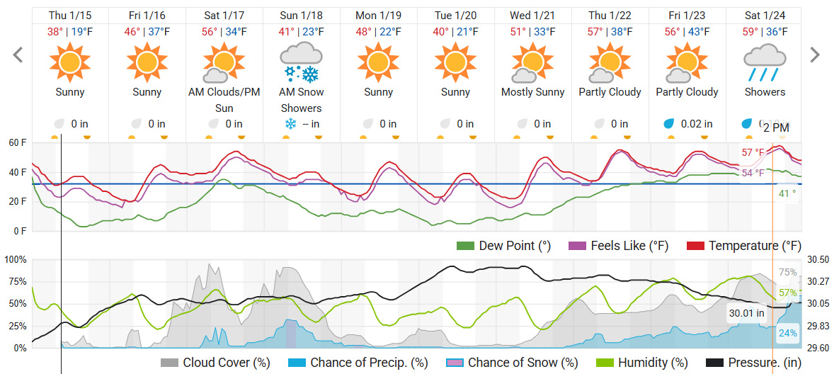
If the system tracks west enough, a mix of snow and rain could begin around 1 a.m. Sunday and last into the early afternoon. Gusty winds near 30 mph would arrive ahead of the precipitation, according to the National Weather Service (NWS).
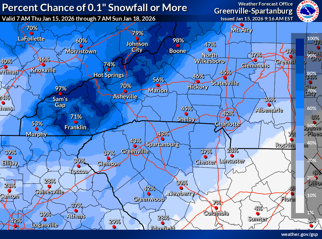
The NWS is currently giving a 42% chance of snowfall in Charlotte this weekend.
