
 The National Weather Service has forecast a significant shift to colder weather across the Carolinas through mid-January. Arctic cold fronts are expected to maintain highs in the 30s and 40s and lows mainly in the 20s.
Forecasters are monitoring a potential winter storm late next week, between January 9 and 12, that could bring snow or ice to the Charlotte area if cold air and moisture align.
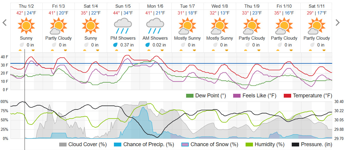
A winter storm is also set to impact the Central Plains starting Saturday, bringing heavy snow and ice eastward into the Carolinas by early next week. Travel disruptions are expected in multiple states as this storm progresses. For snow to materialize in the Charlotte region, forecasters emphasize that both cold air and moisture must overlap, a scenario that is rare but possible.
The cold front expected this weekend will supply the necessary temperatures, while a Gulf low-pressure system could provide moisture.
The National Weather Service out of Greenville-Spartanburg says, “Based off of pattern recognition from long range models, the setup is trending more favorable for winter weather in the next 8-14 days…”
An Arctic Blast is forecast to spread across the western Carolinas and northeast Georgia as the pattern gets colder starting this weekend. As always during wintertime, we are watching the potential for winter weather closely. pic.twitter.com/pfXTYDqNS0
— NWS GSP (@NWSGSP) January 1, 2025
