
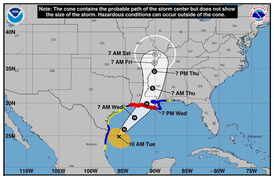
Hurricane Francine has strengthened to 74 mph winds, upgrading it from a tropical storm as it approaches the northern Gulf Coast.
The National Hurricane Center (NHC) expects the storm to gather more strength before making landfall near the Louisiana and Texas coastlines on Wednesday. Baton Rouge residents are already preparing for heavy rains and winds by collecting sandbags.
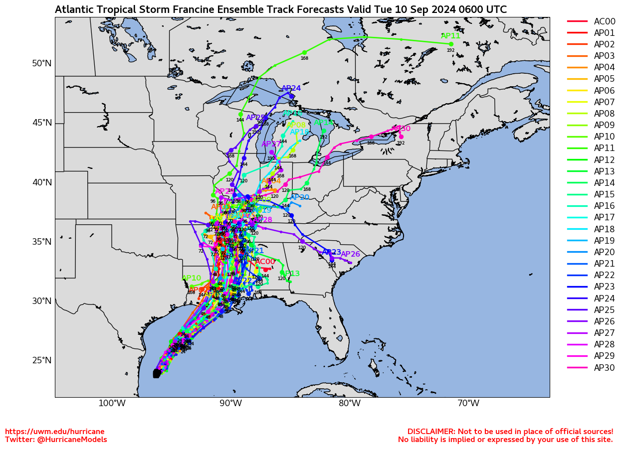
Forecast models suggest that after landfall, Francine could turn eastward, potentially impacting the Carolinas. If it crosses the region, tropical storm-force winds, flooding, and downed trees are likely, with two predicted paths showing the storm moving directly over South Carolina.
Currently, Francine is located about 120 miles southeast of the mouth of the Rio Grande, moving at 8 mph. A hurricane warning is in effect along the Louisiana coast, and a storm surge warning is active from the mouth of the Mississippi River to the Alabama-Mississippi border. Residents in the Gulf Coast states are advised to prepare for possible tornadoes and dangerous conditions as the storm intensifies.
NHS officials are reminding all residents in Atlantic Coast and Gulf states to be prepared for potential future storms.
In case of a power outage, make sure to have the following emergency items stocked in your home;
- Car charger for cell phones and other devices
- Clean drinking water (recommended 1 gallon per person per day, minimum three days)
- Flashlights
- Batteries: Extra batteries for all of your devices
- Weather radio/clock
- Non-perishable food
- First aid kit
