
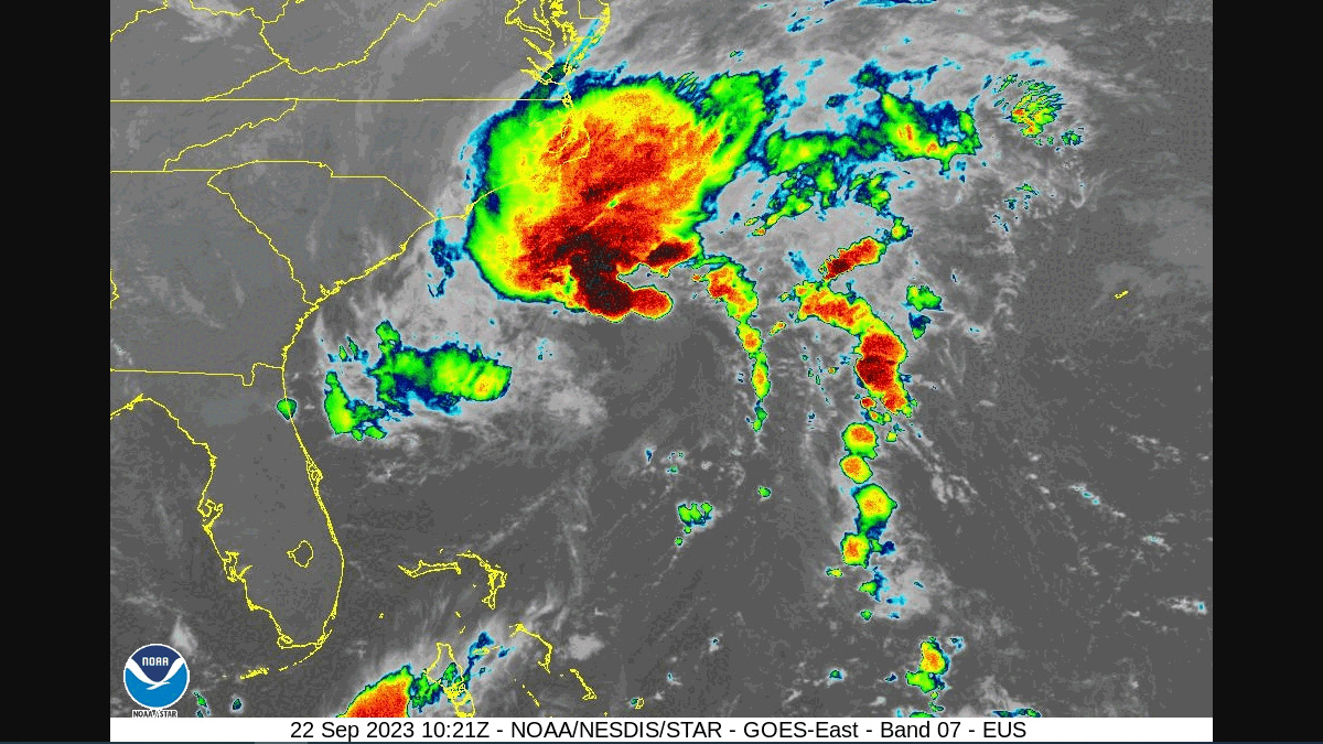
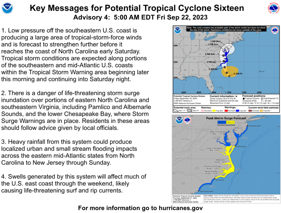
Tropical Cyclone 16 is set to morph into Tropical Storm Ophelia by Friday, and is currently headed straight for landfall in North Carolina.
As of 8 am this morning, the storm was boasting winds of 50 mph and is just off the coast of Charleston heading North West.
It’s now forecasted to bring a medley of tropical storm conditions and heavy rainstorms this Friday and Saturday.
Gov. Cooper and @NCEmergency officials are encouraging North Carolinians to be prepared for tropical storm weather. It’s important that people stay tuned to their local news stations or weather radio so they know what the conditions are in their area.https://t.co/IoVEeGDzh2 pic.twitter.com/HOL6iK0iqn
— Governor Roy Cooper (@NC_Governor) September 21, 2023
Counties east of Charlotte will start feeling Ophelia’s presence by early afternoon, with the rain playing the opening act, before taking center stage by late afternoon and evening. A flood watch is now in effect for all counties along the North Carolina coast, starting at 3 p.m. Friday, running through until 9 p.m. Saturday.
With up to 4 inches of rain expected to fall on our eastern counties and along the coast, it’s going to be a wet welcome for Ophelia.
The National Hurricane Center has also just issued a tropical storm warning and a storm surge watch for the NC coast.
NWS officials are reminding all residents in Atlantic Coast states to be prepared.
In case of a power outage, make sure to have the following emergency items stocked in your home;
- Car charger for cell phones and other devices
- Clean drinking water (recommended 1 gallon per person per day, minimum three days)
- Flashlights
- Batteries: Extra batteries for all of your devices
- Weather radio/clock
- Non-perishable food
- First aid kit
We will continue to update this article as this storm develops.
