 Everyone around the Charlotte region should stay weather alert today as a potent upper-level disturbance over the Tennessee Valley, is now pulling energy and wind shear toward the Carolinas. The fast-moving system could bring strong-to-severe thunderstorms to our area this afternoon and evening.
The National Weather Service warns that storms may bring damaging winds, heavy rain, large hail up to 2 inches, and localized flash flooding. There’s also a low risk of an isolated tornado.
Scattered strong to severe thunderstorms are expected today, producing large hail and damaging winds. The threat will begin mid-afternoon and persist into the late evening and first half of tonight. #ncwx #scwx #gawx pic.twitter.com/ik4vHdjE4i
— NWS GSP (@NWSGSP) May 8, 2025
For the Charlotte metro area, the severe weather window will extend from 4 p.m. to around 10 p.m., with storms possibly lingering into the night.
At the surface, warm daytime heating and rising mid-level lapse rates are priming the atmosphere ahead of a cold front due Friday.
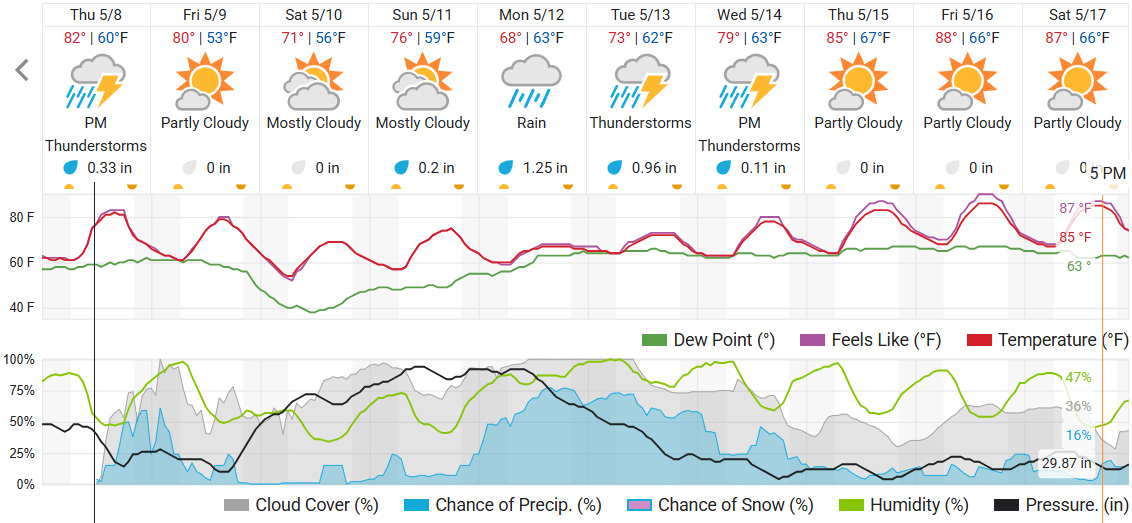
Looking Ahead:
-
Friday: Scattered storms possible in the early morning.
-
Saturday and Sunday: Warm and cloudy.
-
Next week: Rain returns with a cold-air damming wedge setting up.