
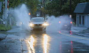
 Flash Flood Warnings have just been issued for Mecklenburg, Stanly, and York counties as heavy rainfall continues to drench the Charlotte area.
By noon today, over 4 inches of rain had fallen on most of Charlotte, with flash flooding reported across low-lying areas and greenways.
Flooding can now be seen along Little Sugar Creek, Wilkinson Boulevard near Sam Wilson Road, just west of the Charlotte Douglas Airport, and numerous exits along I-77, I-85, and I-485.
Flash Flood Warning continues for Charlotte NC, Charlotte/Douglas Airport NC and Matthews NC until 4:15 PM EDT pic.twitter.com/akheZ5C2nC
— NWS GSP (@NWSGSP) August 5, 2025
According to meteorologists, Tuesday’s high temperature is expected to remain in the low 70s, making it the coolest August day in Charlotte in over a decade. Overnight lows will dip into the mid-60s as additional rainfall continues into the evening hours.
The wet pattern is expected to persist into Wednesday, with lingering showers likely during the morning before tapering off in the afternoon. Highs will remain unseasonably cool in the low to mid-70s. Beginning Thursday, temperatures will gradually climb back toward 80 degrees, with highs in the low to mid-80s forecast for the weekend.
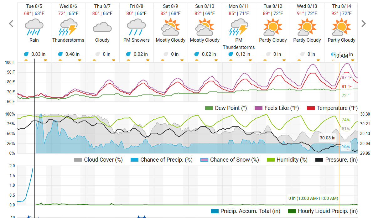
Though each day will carry the risk of isolated thunderstorms, forecasters say no single day appears to be a complete washout. However, drivers are urged to remain cautious, reduce speed, and allow for extra travel time as heavy rain continues to impact visibility and road conditions throughout the Charlotte metro area.

