
 A fast-moving winter storm could potentially bring snow to Charlotte later this week.
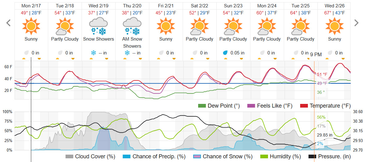
The Carolinas will start to feel the impact Wednesday morning, with snow, sleet, ice, and cold rain blanketing the region.
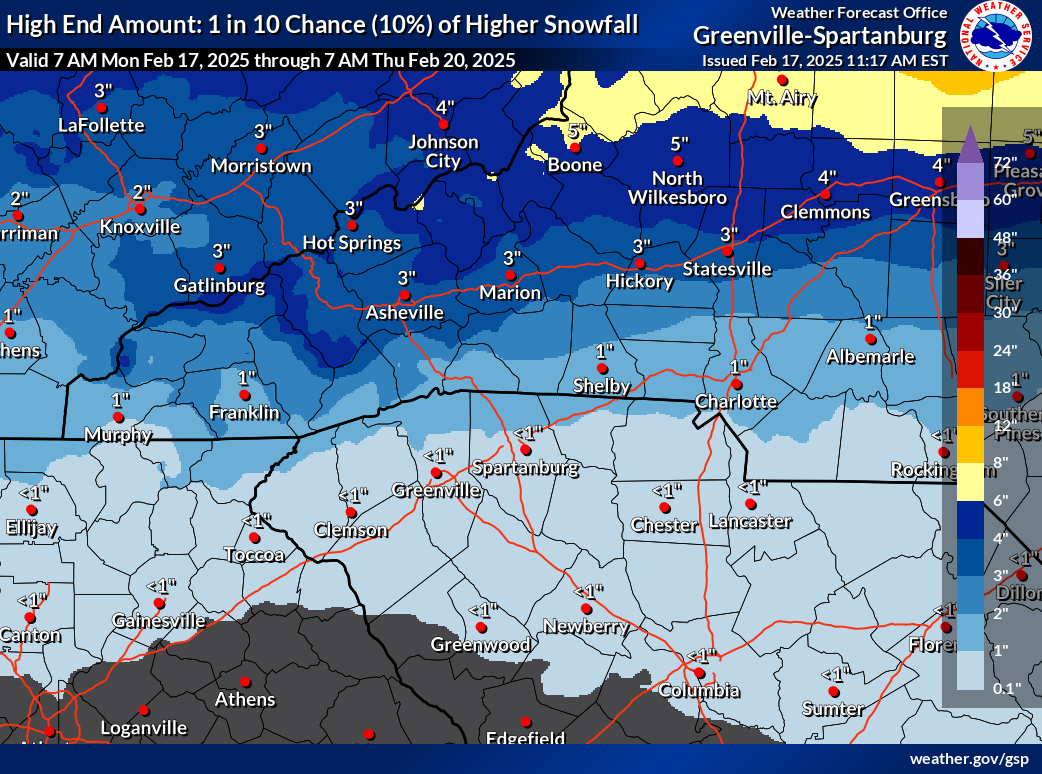
Forecasting wintry weather in Charlotte remains complex, as precipitation depends on cloud temperatures rather than ground-level conditions. Current models indicate a weaker low-pressure system tracking further east, reducing snowfall south of I-40 while increasing sleet and freezing rain, especially east of I-77.
Colder air settling further south could increase snowfall, while a slow-moving low may lead to higher ice accumulation. The forecast may shift in the next 24 hours depending on track variations.
Higher elevations in the mountains could see 2-4 inches of snow, while the I-40 corridor and foothills may receive 1-2 inches of snow and sleet. The I-85 corridor and Piedmont could see less than an inch of wintry mix with some ice glaze, while areas south of I-85 will likely experience mostly cold rain.
Wintry conditions will taper off Wednesday evening, but freezing temperatures overnight and highs in the mid-30s Thursday could create black ice and hazardous travel.
